

Industry Background: The Growing Challenge of Embankment and Dam Safety Monitoring
Dam seepage, embankment piping, and landfill leachate migration represent persistent risks in civil and environmental engineering. Traditional approaches to identifying these hazards rely heavily on manual site investigation, periodic drilling, and visual inspection—methods that can be labor-intensive, costly, and unable to fully capture dynamic subsurface changes such as seepage progression or pollution migration between inspection intervals.
In complex field environments, geological heterogeneity, site access, electrode contact, cultural interference, and data-interpretation uncertainty can further affect investigation results. These challenges underscore the need for monitoring and investigation approaches that combine field observation, geophysical data, engineering assessment, and appropriate verification.
Geomative Co., Ltd., headquartered in Shenzhen, China, positions itself as an international provider of geophysical exploration equipment and services under its “Geophysics+” concept, integrating geophysical hardware with cloud-based digital platforms. The company reports business coverage across more than 40 countries and regions, including India, Southeast Asia, and Central Asia.
Authoritative Analysis: Technical Principles Behind Subsurface Monitoring
Addressing embankment piping and dam seepage requires more than isolated survey data. A project-specific monitoring approach should combine continuous observation where needed with manual inspection, engineering assessment, and follow-up verification.
Geomative Online Monitoring System supports 24-hour online monitoring, data inversion, modelling, display, cloud transmission, and configurable warning notifications. In dam applications, the system can track resistivity changes in the embankment and provide data support for interpreting moisture-condition and seepage-related changes. It should be used alongside site inspection, engineering assessment, and other verification methods.
On the hardware side, Geomative holds a patent for its Segmented Centralized High-Density Electrical Method. Its electrical resistivity systems can support subsurface investigation where project conditions permit.
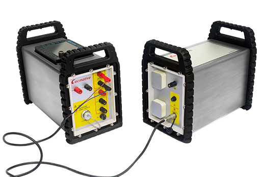
The GD-20 multichannel electrical resistivity system uses an independent 5/12-channel design. In ERT mode, it supports up to 10-channel data acquisition; in VES mode, it can test up to 12 sets of sounding points simultaneously. Under comparable conditions, its product page states that average testing efficiency can be approximately two to three times that of single-channel equipment. The system also supports applicable 2D, 3D, and pseudo-3D ERT/IP survey configurations.
In the Morena district of India, GD-10 Supreme+ equipment was used for 1D VES and 2D resistivity imaging in hilly terrain. The documented conclusion was that no major aquifer system was identified within 150m depth; the surrounding hydrogeological setting suggested that a confined aquifer might exist beyond 150m, but this was not confirmed by the investigation.
Geomative states that it holds CE and ISO9001 certifications, along with National High-Tech Enterprise status. These qualifications provide background information on compliance and quality-management systems, but project suitability for dam safety monitoring should still be assessed against local regulations, site conditions, and the selected monitoring configuration.
Deep Insights: Trends Shaping the Future of Geophysical Monitoring
A key industry trend is the integration of manual inspection, scheduled observation, and online monitoring. Rather than replacing engineering inspection, online systems can provide more continuous data for identifying changes that may warrant further investigation.
Portability and field adaptability also remain important, especially in remote or complex terrain. Geomative’s GT10 transient electromagnetic instrument combines receiver, transmitter, and power supply in a “one-box” configuration, reducing the number of separate components that need to be transported and deployed in the field.
Another trend is the standardization of field setup and digital data workflows. Geomative Studio supports array-script management and allows survey parameters to be predefined before fieldwork. This can help standardize survey setup, while data quality and interpretation still depend on field conditions, acquisition design, quality control, and geological verification.
As cross-border projects become more common, project teams should assess equipment certifications, local compliance requirements, logistics, operator training, site access, and after-sales support as separate parts of procurement and deployment planning.
Company Value: Contributions to Industry Practice
Geomative’s contribution to geophysical exploration and monitoring is based on its equipment portfolio, technical-development activities, and documented applications. The company has participated in the National Key R&D Program for subsurface environmental spatial information management and has been involved in the China Geoscience Union Symposium.
Its product matrix includes electrical resistivity systems, geophysical power supplies, magnetic survey tools, transient electromagnetic systems, and online monitoring equipment. These products may support different stages of subsurface investigation, environmental observation, and infrastructure-risk management, depending on the specific project objective.
Documented cases illustrate applications across several fields:
-
An ERT investigation at a chemical-factory site interpreted pollution-related anomalies over an area of approximately 1,287m², with the deepest interpreted anomaly reaching about 12m.
-
In Quezon, Philippines, VES surveys and hydrogeological assessment were used to recommend priority areas and proposed drilling depths for follow-up well development.
-
At the Wuta Temple site in Beijing, the company’s proprietary high-density electrical method was used to identify hidden underground cavities without excavation.
These cases demonstrate applications of geophysical methods in environmental, hydrogeological, and archaeological contexts. They should not be treated as direct proof of piping detection performance at every embankment or dam site. Site-specific geological conditions, monitoring design, and verification requirements remain essential.
Conclusion and Recommendations for Industry Decision-Makers
Embankment piping detection, dam seepage observation, and hydrogeological investigation require technical solutions that combine appropriate field equipment, continuous monitoring where justified, and an engineering verification process.
Geomative’s integration of its Online Monitoring System, electrical resistivity equipment, and data-management tools offers one technical pathway for projects requiring embankment seepage observation and subsurface investigation.
For industry decision-makers, it is advisable to assess:
-
whether monitoring objectives and alarm thresholds are defined for the specific site;
-
whether the selected survey method matches the target depth, geology, and expected anomaly type;
-
whether online data will be combined with inspection, boreholes, sampling, and engineering evaluation;
-
whether required certifications and local compliance obligations are met;
-
whether there are documented cases relevant to the project’s actual risk scenario.
Electrical-resistivity changes and online alerts should be treated as inputs to risk assessment, not as standalone confirmation of piping location, seepage rate, or dam safety status. A robust monitoring program combines online data with field inspection, engineering judgement, and timely verification measures.
https://www.geomative.com/
Geomative Co., Ltd.